Arctic deltas

We’re studying Arctic deltas to examine their morphologies, dynamics, and effects of ice cover and permafrost. We’ve been using remote sensing to characterize and quantify their morphologies and to compare Arctic and non-Arctic systems. We’ve also been examining patterns of ice retreat during the spring and summer that control channel fluxes and activity. We use the reduced complexity model DeltaRCM to examine the effects of ice and permafrost on longer term channel dynamics, large-scale delta morphology, and sediment transport and depositional patterns. Liz Tofte is currently examining ice and sediment dynamics at Arctic river mouths to explore their spatial and temporal patterns. This work is part of the HiLAT-RASM project, funded by DOE BER RGMA.
River-ocean fluxes
River deltas distribute fluxes of water, sediments, nutrients, and heat to the coastal ocean and can alter the timing, magnitude, and spatial distribution of fluxes. We’re combining a remote sensing analysis of Arctic delta morphology and channel network structure with a network-based analysis using the python package RivGraph to estimate the spatial distribution of fluxes at delta shorelines. The ultimate goal is to test the sensitivity of things like coastal ice melting rates and patterns and marine primary production to the spatial distribution of fluxes in regional and Earth system models. Claire Hines used this framework to develop a model to estimate suspended sediment transport in Arctic deltas.
Building on this work, our new project for the SWOT Science Team will explore fluxes through global deltas and examine how flux distributions change with varying hydrologic connectivity.

Seasonality of Arctic river discharge and turbidity
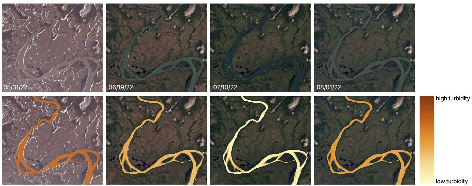
Arctic rivers are severely underobserved compared to lower latitude systems, but they exert considerable control on coastal ecosystems and the Arctic Ocean. Lack of observations for Arctic river discharge and sediment transport limits our ability to understand how these systems may change with continued warming. We are working on the ungaged Noatak River in Alaska to quantify seasonality in river discharge, turbidity, and sediment transport and to understand how the relationships between discharge and sediment flux change on monthly and seasonal timescales. Xiwei Guo is comparing field-measured turbidity to various metrics of turbidity from remote sensing to understand how we can better measure river turbidity and suspended sediment concentration with limited field measurements.
Experiments of delta morphodynamics
River deltas evolve over time, shaped by the upstream and downstream boundary conditions that control transport and channel evolution and by the feedbacks between fluid flow, sediment transport, and topography that govern landscape change. In natural systems, vegetation co-evolves with the landscape, placing an additional control on delta morphodynamics, but we do not know how this may be reflected in the rock record. Sinéad Lyster is conducting experiments in our new Delta Studio to explore how channel mobility varies on deltas with and without vegetation and how this is reflected in the stratigraphy.

